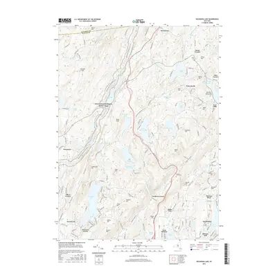
2016 Map of Oscawana Lake
USGS Topo · Published 2016About this map
Mahopac and the surrounding Hudson Highlands are defined by a complex network of water resources and rugged summits in this Putnam County survey. The landscape is dominated by the sprawling Clarence Fahnestock Mem St Pk, which preserves much of the terrain around Canopus Lake and the Appalachian National Scenic Trail. Engineering for the New York City water supply system is evident through the path of the Delaware Aqueduct and the presence of the Wiccopee Reservoir and Boyd Corners Reservoir.
Find a feature on this map
77 named features on this map. Tap any name to fly to it.
Don’t see what you’re looking for? This feature index may not catch every label — zoom into the map to look around manually.
Map Details
Editions of this 2016 Oscawana Lake Map
This is the sole edition of this map. No revisions or reprints were ever made.
Other maps of this area

1892 · West Point
USGS Topo · 1:62,500

1892 · Carmel
USGS Topo · 1:62,500

1893 · Carmel
USGS Topo · 1:62,500

1893 · Clove
USGS Topo · 1:62,500

1893 · Poughkeepsie
USGS Topo · 1:62,500

1894 · West Point
USGS Topo · 1:62,500

1894 · Clove
USGS Topo · 1:62,500

1894 · Carmel
USGS Topo · 1:62,500

1894 · Poughkeepsie
USGS Topo · 1:62,500

1898 · Clove
USGS Topo · 1:62,500