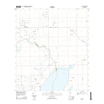
2015 Map of Osceola
USGS Topo · Published 2015About this map
The Saint Johns River defines the boundary between Volusia Co and Seminole Co as it meanders toward the northern reaches of Lake Harney. This landscape is characterized by a complex network of wetlands and drainage, featuring the Deep Cr Diversion Canal and natural waterways like Cow House Slough and Deep Creek. The settlements of Osceola and Pennichaw sit near the river’s edge, while Kalamazoo and Farmton are situated further inland along the Osteen Maytown RD corridor.
Find a feature on this map
118 named features on this map. Tap any name to fly to it.
Don’t see what you’re looking for? This feature index may not catch every label — zoom into the map to look around manually.
Map Details
Editions of this 2015 Osceola Map
This is the sole edition of this map. No revisions or reprints were ever made.
Other maps of this area

1949 · Osceola
USGS Topo · 1:24,000

1950 · Maytown
USGS Topo · 1:24,000

1950 · Edgewater
USGS Topo · 1:24,000

1950 · Aurantia
USGS Topo · 1:24,000

1953 · Geneva
USGS Topo · 1:24,000

1955 · Orlando
USGS Topo · 1:250,000

1956 · Oviedo
USGS Topo · 1:24,000

1957 · Orlando
USGS Topo · 1:250,000

1958 · Orlando
USGS Topo · 1:250,000

1962 · Orlando
USGS Topo · 1:250,000