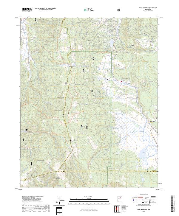
2023 Map of Osha Mountain
USGS Topo · Published 2023About this map
Carson National Forest encompasses much of this high-elevation landscape, where the Santa Fe Mountains and Sangre de Cristo Mountains converge. The settlement of Angel Fire occupies the northern reaches of the sheet, characterized by a dense network of mountain roads such as Peralta Dr and Woodland Dr. This area serves as a primary hub for the region's contemporary alpine activity, contrasted by the more dispersed residential pattern found further south near Black Lake.
Find a feature on this map
98 named features on this map. Tap any name to fly to it.
Don’t see what you’re looking for? This feature index may not catch every label — zoom into the map to look around manually.
Map Details
Editions of this 2023 Osha Mountain Map
This is the sole edition of this map. No revisions or reprints were ever made.
Other maps of this area

1954 · Raton
USGS Topo · 1:250,000

1956 · Tooth Of Time
USGS Topo · 1:62,500

1958 · Raton
USGS Topo · 1:250,000

1965 · Osha Mountain
USGS Topo · 1:24,000

1965 · Chacon
USGS Topo · 1:24,000

1965 · Palo Flechado Pass
USGS Topo · 1:24,000

1965 · Pueblo Peak
USGS Topo · 1:24,000

1965 · Shady Brook
USGS Topo · 1:24,000
1965 · Cerro Vista
USGS Topo · 1:24,000

1966 · Guadalupita
USGS Topo · 1:24,000