
1965 Map of Osha Mountain
USGS Topo · Published 1968About this map
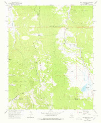
Carson National Forest dominates this mid-1960s landscape, where complex land grant boundaries meet the rugged topography of the Rincon Mountains. The map documents a sparsely settled region defined by the convergence of several major land holdings, including the Beaubien and Miranda (Maxwell) grant and the Rancho del Rio Grande. In the eastern valley, the settlement of Black Lake serves as a focal point near the San Antonio Ch, while a network of pack trails and jeep trails provides access through high-altitude terrain at Osha Pass and Quintana Pass. Numerous watercourses, such as Coyote Creek and Cieneguilla Creek, carve through the high country, creating a drainage pattern that historically dictated the movement of livestock and people between these isolated mountain parks and the larger valley basins.
Find a feature on this map
32 named features on this map. Tap any name to fly to it.
Don’t see what you’re looking for? This feature index may not catch every label — zoom into the map to look around manually.
Map Details
Editions of this 1965 Osha Mountain Map
2 editions found
Other maps of this area

1954 · Raton
USGS Topo · 1:250,000

1956 · Tooth Of Time
USGS Topo · 1:62,500

1958 · Raton
USGS Topo · 1:250,000

1965 · Chacon
USGS Topo · 1:24,000

1965 · Palo Flechado Pass
USGS Topo · 1:24,000

1965 · Pueblo Peak
USGS Topo · 1:24,000

1965 · Shady Brook
USGS Topo · 1:24,000
1965 · Cerro Vista
USGS Topo · 1:24,000

1966 · Guadalupita
USGS Topo · 1:24,000

1983 · Taos
USGS Topo · 1:100,000