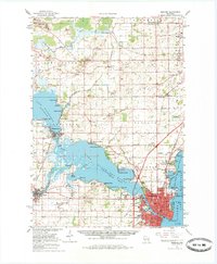
1961 Map of Oshkosh
USGS Topo · Published 1970About this map
The city of Oshkosh anchors the southern end of this 1961 survey, where the Fox River flows through the urban grid toward Lake Winneconne and Lake Butte des Morts. The landscape is a complex network of waterways and marshlands, including the wide Wolf River and Nickels Marsh, shaping the development of lakeside settlements like Winneconne and Butte des Morts. This era shows a community defined by its institutional and educational landmarks, featuring the extensive grounds of the Winnebago State Hospital and Wisconsin State College.
Find a feature on this map
108 named features on this map. Tap any name to fly to it.
Don’t see what you’re looking for? This feature index may not catch every label — zoom into the map to look around manually.
Map Details
Editions of this 1961 Oshkosh Map
2 editions found

Other maps of this area

1910 · Fond du Lac
USGS Topo · 1:62,500

1911 · Neenah
USGS Topo · 1:62,500

1916 · Ripon
USGS Topo · 1:48,000

1918 · Ripon
USGS Topo · 1:62,500

1955 · Neenah
USGS Topo · 1:62,500

1955 · Appleton
USGS Topo · 1:24,000

1955 · Appleton
USGS Topo · 1:62,500

1955 · Neenah
USGS Topo · 1:24,000

1955 · Fond Du Lac
USGS Topo · 1:62,500

1955 · Green Bay
USGS Topo · 1:250,000