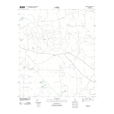
2011 Map of Osierfield
USGS Topo · Published 2011About this map
Osierfield serves as the focal point of this South Georgia landscape, situated within a network of agricultural roads and slow-moving watercourses. The territory is defined by its numerous family and church burial grounds, including the Osierfield Cemetery, McMillan Cemetery, and New Bethel Cemetery, which provide significant anchor points for local genealogical research. The drainage patterns of the coastal plain are evident through the meandering paths of the Seventeen Mile River and Hunters Creek, while several impoundments like Metz Lake and Dicksons Millpond suggest a history of water management for local use.
Find a feature on this map
65 named features on this map. Tap any name to fly to it.
Don’t see what you’re looking for? This feature index may not catch every label — zoom into the map to look around manually.
Map Details
Editions of this 2011 Osierfield Map
This is the sole edition of this map. No revisions or reprints were ever made.
Other maps of this area

1953 · Waycross
USGS Topo · 1:250,000

1958 · Waycross
USGS Topo · 1:250,000

1972 · Broxton North
USGS Topo · 1:24,000

1972 · Jacksonville
USGS Topo · 1:24,000

1972 · Fitzgerald East
USGS Topo · 1:24,000

1972 · Ambrose
USGS Topo · 1:24,000

1972 · China Hill
USGS Topo · 1:24,000

1972 · Ocilla East
USGS Topo · 1:24,000

1972 · Queensland
USGS Topo · 1:24,000

1977 · Osierfield
USGS Topo · 1:24,000