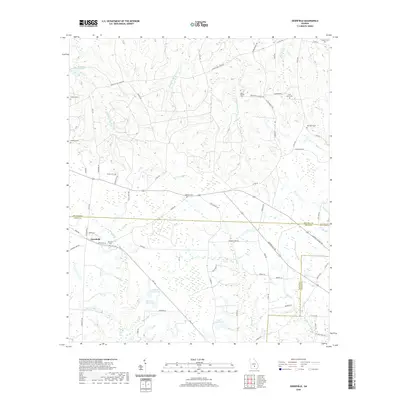
2020 Map of Osierfield
USGS Topo · Published 2020About this map
Osierfield sits at a geographic crossroads along the boundary of Ben Hill and Irwin Counties, representing a classic South Georgia landscape of managed water and family legacies. This area is defined by its extensive network of named cemeteries, such as Saint Pauls Cem and Old Union Cem, which serve as vital markers for local genealogical research. The terrain is structured by drainages like the Seventeen Mile River and Little Sturgeon Cr, which feed into numerous localized impoundments including Dicksons Millpond and Faulkner Lake North. The map reveals a dense rural road network, with names like Ashton School Rd and Dicksons Mill Pond Rd hinting at the former locations of early community centers and industrial sites that once anchored this agricultural region near the Coffee County line.
Find a feature on this map
78 named features on this map. Tap any name to fly to it.
Don’t see what you’re looking for? This feature index may not catch every label — zoom into the map to look around manually.
Map Details
Editions of this 2020 Osierfield Map
This is the sole edition of this map. No revisions or reprints were ever made.
Other maps of this area

1953 · Waycross
USGS Topo · 1:250,000

1958 · Waycross
USGS Topo · 1:250,000

1972 · Broxton North
USGS Topo · 1:24,000

1972 · Jacksonville
USGS Topo · 1:24,000

1972 · Fitzgerald East
USGS Topo · 1:24,000

1972 · Ambrose
USGS Topo · 1:24,000

1972 · China Hill
USGS Topo · 1:24,000

1972 · Ocilla East
USGS Topo · 1:24,000

1972 · Queensland
USGS Topo · 1:24,000

1977 · Osierfield
USGS Topo · 1:24,000