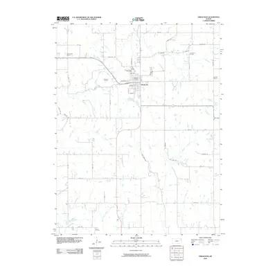
2009 Map of Oskaloosa
USGS Topo · Published 2009About this map
Oskaloosa serves as the focal point of this Jefferson County landscape, where the local street grid centers on the Oskaloosa Post Office. The surrounding terrain is defined by a dense network of tributaries including Slough Creek, Buck Creek, and Plum Creek, which carve through the agricultural uplands. Rural life is anchored by several named institutions that provide significant value for genealogical research, such as the Buck Point School, Leaverton School, and Hinton School. The presence of these small schools alongside the Pleasant View Cemetery and Buster Cemetery reflects a long-established pattern of community nodes scattered across the countryside. To the west of the main settlement, Shomin Airport indicates a modern layer of infrastructure, while the confluence of West Stone House Creek and East Stone House Creek highlights the intricate drainage system that has historically shaped land use in this part of Kansas.
Find a feature on this map
53 named features on this map. Tap any name to fly to it.
Don’t see what you’re looking for? This feature index may not catch every label — zoom into the map to look around manually.
Map Details
Editions of this 2009 Oskaloosa Map
This is the sole edition of this map. No revisions or reprints were ever made.
Other maps of this area

1886 · Oskaloosa
USGS Topo · 1:125,000

1888 · Oskaloosa
USGS Topo · 1:125,000

1894 · Oskaloosa
USGS Topo · 1:125,000

1949 · Williamstown
USGS Topo · 1:24,000

1949 · Perry
USGS Topo · 1:24,000

1950 · Perry
USGS Topo · 1:24,000

1950 · Kansas City
USGS Topo · 1:250,000

1950 · Williamstown
USGS Topo · 1:24,000
1950 · Midland
USGS Topo · 1:24,000

1950 · Mc Louth
USGS Topo · 1:24,000