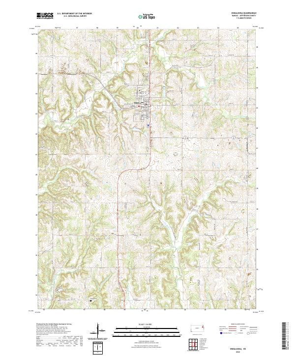
2022 Map of Oskaloosa
USGS Topo · Published 2022About this map
Oskaloosa serves as the central hub of this Jefferson County landscape, where the Jefferson County Courthouse stands at the heart of the community. The town is surrounded by a complex network of drainage basins and creeks, including the winding course of Slough Cr and the waters of Honey Cr. For those researching local families and genealogy, several burial grounds are recorded here, notably Pleasant View Cem and the more remote Buster Cem. The terrain is defined by its numerous tributaries, such as Little Wild Horse Cr, E State House Cr, and W Stone House Cr, which carve through the farmland. A dense grid of rural roads like Osage Rd and Nemaha Rd connects the various sections and townships, illustrating the persistent agricultural layout of this Kansas region.
Find a feature on this map
65 named features on this map. Tap any name to fly to it.
Don’t see what you’re looking for? This feature index may not catch every label — zoom into the map to look around manually.
Map Details
Editions of this 2022 Oskaloosa Map
This is the sole edition of this map. No revisions or reprints were ever made.
Other maps of this area

1886 · Oskaloosa
USGS Topo · 1:125,000

1888 · Oskaloosa
USGS Topo · 1:125,000

1894 · Oskaloosa
USGS Topo · 1:125,000

1949 · Williamstown
USGS Topo · 1:24,000

1949 · Perry
USGS Topo · 1:24,000

1950 · Perry
USGS Topo · 1:24,000

1950 · Kansas City
USGS Topo · 1:250,000

1950 · Williamstown
USGS Topo · 1:24,000
1950 · Midland
USGS Topo · 1:24,000

1950 · Mc Louth
USGS Topo · 1:24,000