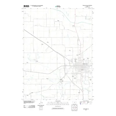
2010 Map of Oskaloosa
USGS Topo · Published 2010About this map
Oskaloosa serves as the focal point of this Iowa landscape, where established civic structures like the Oskaloosa Bandstand and the Oskaloosa Post Office anchor the town center. The presence of Iowa Union College and the Southern Iowa Fairgrounds, home to the Southern Iowa Speedway, indicates a regional hub for education and community gatherings. Surrounding the city, smaller settlements such as Beacon, Evans, and Bolton are connected by a dense grid of rural roads and waterways including Muchakinock Creek and the South Skunk River.
Find a feature on this map
65 named features on this map. Tap any name to fly to it.
Don’t see what you’re looking for? This feature index may not catch every label — zoom into the map to look around manually.
Map Details
Editions of this 2010 Oskaloosa Map
This is the sole edition of this map. No revisions or reprints were ever made.
Other maps of this area

1910 · Pella
USGS Topo · 1:62,500

1912 · Pella
USGS Topo · 1:62,500

1929 · Albia
USGS Topo · 1:62,500

1954 · Des Moines
USGS Topo · 1:250,000

1956 · Des Moines
USGS Topo · 1:250,000

1957 · Des Moines
USGS Topo · 1:250,000

1968 · University Park
USGS Topo · 1:24,000

1968 · Oskaloosa
USGS Topo · 1:24,000

1968 · Kirkville
USGS Topo · 1:24,000

1968 · Eddyville
USGS Topo · 1:24,000