2022 Map of Oskaloosa
USGS Topo · Published 2022About this map
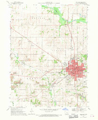
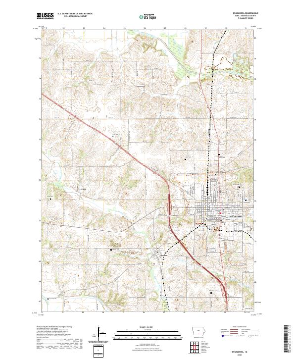
Oskaloosa stands as a significant regional hub in this modern survey, characterized by its dense grid and the presence of the Mahaska County Courthouse and William Penn University. The landscape surrounding the city is defined by the winding course of the South Skunk River to the north and a network of creeks including Muchakinock Cr and Painter Cr. This area is a dense landscape for genealogical research, with an exceptional number of small, named burial grounds scattered across the townships, such as Madison Cem, Prine Cem, and Evans Cem. The transition from the rural community of Evans and the village of Beacon into the city limits is bridged by the Mahaska Community Recreational Trl, which follows former transportation corridors. This modern documentation preserves the layout of local infrastructure, from Newland Way in the south to the northern reaches of the South Skunk River.
Find a feature on this map
52 named features on this map. Tap any name to fly to it.
Don’t see what you’re looking for? This feature index may not catch every label — zoom into the map to look around manually.
Map Details
Editions of this 2022 Oskaloosa Map
This is the sole edition of this map. No revisions or reprints were ever made.
Historical Maps of Oskaloosa Through Time
3 maps found