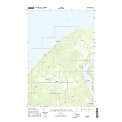
2017 Map of Oskar
USGS Topo · Published 2017About this map
Little America and the community of Oskar occupy this coastal portion of the Keweenaw Peninsula, where the land meets the expansive waters of Lake Superior. The landscape is defined by its relationship to the Keweenaw Waterway, which separates the mainland from the rugged peninsula. In the early 21st century, this area remains a network of rural routes such as Houghton Canal Rd and Stanton Shores Rd, connecting small settlements like Liminga and Schmidt Corner.
Find a feature on this map
51 named features on this map. Tap any name to fly to it.
Don’t see what you’re looking for? This feature index may not catch every label — zoom into the map to look around manually.
Map Details
Editions of this 2017 Oskar Map
This is the sole edition of this map. No revisions or reprints were ever made.
Other maps of this area

1915 · Houghton
USGS Topo · 1:62,500

1946 · Hancock
USGS Topo · 1:24,000

1946 · Chassell
USGS Topo · 1:24,000

1946 · South Range
USGS Topo · 1:24,000

1946 · Muggun Creek
USGS Topo · 1:24,000

1948 · South Range
USGS Topo · 1:24,000
1948 · Muggun Creek
USGS Topo · 1:24,000

1948 · Hancock
USGS Topo · 1:24,000

1948 · Chassell
USGS Topo · 1:24,000

1954 · Graveraet River
USGS Topo · 1:24,000