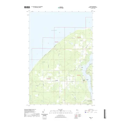
2019 Map of Oskar
USGS Topo · Published 2019About this map
The coastline of Lake Superior and the sheltered Keweenaw Waterway define the settlement patterns of this northern Michigan landscape. Small communities like Oskar and Liminga are connected by a network of rural roads, many bearing family names like Jackola Rd and Lahnala Rd, which reflect the area's ancestral heritage. The topography rises from the marshy banks near Harrington Island toward significant elevations at High Point.
Find a feature on this map
48 named features on this map. Tap any name to fly to it.
Don’t see what you’re looking for? This feature index may not catch every label — zoom into the map to look around manually.
Map Details
Editions of this 2019 Oskar Map
This is the sole edition of this map. No revisions or reprints were ever made.
Other maps of this area

1915 · Houghton
USGS Topo · 1:62,500

1946 · Hancock
USGS Topo · 1:24,000

1946 · Chassell
USGS Topo · 1:24,000

1946 · South Range
USGS Topo · 1:24,000

1946 · Muggun Creek
USGS Topo · 1:24,000

1948 · South Range
USGS Topo · 1:24,000
1948 · Muggun Creek
USGS Topo · 1:24,000

1948 · Hancock
USGS Topo · 1:24,000

1948 · Chassell
USGS Topo · 1:24,000

1954 · Graveraet River
USGS Topo · 1:24,000