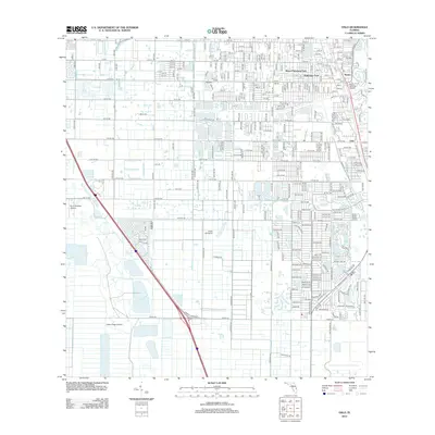
2012 Map of Oslo
USGS Topo · Published 2012About this map
The Indian River shoreline south of Vero Beach defines this coastal landscape, where the historic citrus and shipping community of Oslo sits alongside the northern reaches of the Treasure Coast. This period shows a distinct transition from the established settlements at Nevins and Poinciana Park to an area increasingly defined by aviation and conservation. Multiple private airstrips, including Fly in Ranches Airport, Triple M Airport, and Falcon Ridge Airpark, are scattered across the western citrus groves and flatlands, illustrating the region's reliance on private flight.
Find a feature on this map
120 named features on this map. Tap any name to fly to it.
Don’t see what you’re looking for? This feature index may not catch every label — zoom into the map to look around manually.
Map Details
Editions of this 2012 Oslo Map
This is the sole edition of this map. No revisions or reprints were ever made.
Other maps of this area

1948 · Riomar
USGS Topo · 1:24,000

1948 · Indrio
USGS Topo · 1:24,000

1949 · Fort Pierce
USGS Topo · 1:24,000

1949 · Vero Beach
USGS Topo · 1:24,000

1949 · Oslo
USGS Topo · 1:24,000

1949 · Fort Pierce NW
USGS Topo · 1:24,000

1950 · Riomar
USGS Topo · 1:24,000

1950 · Fort Pierce
USGS Topo · 1:24,000

1950 · Fort Pierce NW
USGS Topo · 1:24,000

1950 · Oslo
USGS Topo · 1:24,000