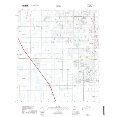
2018 Map of Oslo
USGS Topo · Published 2018About this map
Vero Beach and its surrounding southern developments anchor the northeastern corner of this Atlantic coast landscape, where the residential expansion of Vero Beach South meets the structured neighborhoods of Royal Poinciana Park. The area's citrus heritage and early transport routes are reflected in the grid of Florida Ridge and the settlement at Oslo, which sits just inland from the Indian River. To the south, the county line between Indian River County and St. Lucie County bisects suburban communities like Lakewood Park. This 2018 survey reveals a modern coastal corridor defined by a dense network of residential streets such as Glendale Road and 8th Street, illustrating the transition from agricultural tracts to a continuous residential landscape between the mainland's interior and the lagoon shoreline.
Find a feature on this map
110 named features on this map. Tap any name to fly to it.
Don’t see what you’re looking for? This feature index may not catch every label — zoom into the map to look around manually.
Map Details
Editions of this 2018 Oslo Map
This is the sole edition of this map. No revisions or reprints were ever made.
Other maps of this area

1948 · Riomar
USGS Topo · 1:24,000

1948 · Indrio
USGS Topo · 1:24,000

1949 · Fort Pierce
USGS Topo · 1:24,000

1949 · Vero Beach
USGS Topo · 1:24,000

1949 · Oslo
USGS Topo · 1:24,000

1949 · Fort Pierce NW
USGS Topo · 1:24,000

1950 · Riomar
USGS Topo · 1:24,000

1950 · Fort Pierce
USGS Topo · 1:24,000

1950 · Fort Pierce NW
USGS Topo · 1:24,000

1950 · Oslo
USGS Topo · 1:24,000