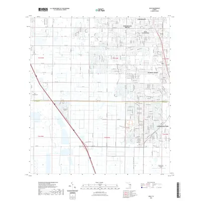
2021 Map of Oslo
USGS Topo · Published 2021About this map
Indian River frontage and the residential expansion of the Florida coast dominate this 2021 survey of the area south of Vero Beach. The map highlights the transition from established neighborhoods like Royal Poinciana Park and Nevins to the suburban sprawl of Florida Ridge and Lakewood Park. A distinct local history is preserved at the Oslo Cem near the historic settlement of Oslo, providing a point of reference for genealogists. The landscape is heavily defined by its grid of numbered streets and avenues, alongside specialized features like the Fly in Ranches Airport and the Lakewood Park Natural Area Trl, which offer a contrast to the dense development. This modern snapshot also captures the administrative boundary between Indian River Co and St Lucie Co.
Find a feature on this map
142 named features on this map. Tap any name to fly to it.
Don’t see what you’re looking for? This feature index may not catch every label — zoom into the map to look around manually.
Map Details
Editions of this 2021 Oslo Map
This is the sole edition of this map. No revisions or reprints were ever made.
Other maps of this area

1948 · Riomar
USGS Topo · 1:24,000

1948 · Indrio
USGS Topo · 1:24,000

1949 · Fort Pierce
USGS Topo · 1:24,000

1949 · Vero Beach
USGS Topo · 1:24,000

1949 · Oslo
USGS Topo · 1:24,000

1949 · Fort Pierce NW
USGS Topo · 1:24,000

1950 · Riomar
USGS Topo · 1:24,000

1950 · Fort Pierce
USGS Topo · 1:24,000

1950 · Fort Pierce NW
USGS Topo · 1:24,000

1950 · Oslo
USGS Topo · 1:24,000