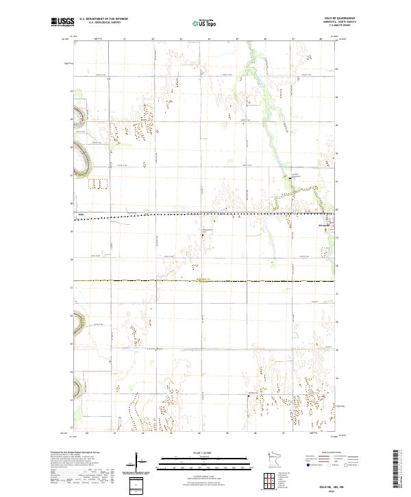
2022 Map of Oslo NE
USGS Topo · Published 2022About this map
The Red River of the North forms a jagged natural boundary between Minnesota and North Dakota, anchoring this section of the fertile Red River Valley. The settlement of Oslo sits at a critical crossing point along the western edge, while the town of Alvarado serves as a secondary hub to the east. The landscape is defined by a rigid section-line grid of rural roads, including Co Hwy 17 and Co Hwy 9, which divide the vast agricultural fields characteristic of Marshall County. Genealogists and local historians will find significant value in the preservation of several rural burial grounds, such as the Swedish Evangelical Cem, Mesopotamia Cem, and the southern Swedish Cem. These sites, along with the meandering path of the Snake River, provide fixed landmarks in a region otherwise dominated by large-scale farming and the seasonal dynamics of the Red River floodplain.
Find a feature on this map
35 named features on this map. Tap any name to fly to it.
Don’t see what you’re looking for? This feature index may not catch every label — zoom into the map to look around manually.
Map Details
Editions of this 2022 Oslo NE Map
This is the sole edition of this map. No revisions or reprints were ever made.
Other maps of this area

1918 · Acton
USGS Topo · 1:62,500

1918 · Argyle
USGS Topo · 1:62,500

1918 · Warren
USGS Topo · 1:62,500

1952 · Thief River Falls
USGS Topo · 1:250,000

1954 · Stephen
USGS Topo · 1:62,500

1955 · Warren
USGS Topo · 1:62,500

1956 · Thief River Falls
USGS Topo · 1:250,000

1957 · Thief River Falls
USGS Topo · 1:250,000
1966 · Oslo NE
USGS Topo · 1:24,000
1966 · Big Woods
USGS Topo · 1:24,000