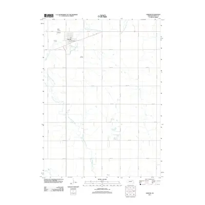
2011 Map of Osmond
USGS Topo · Published 2011About this map
Osmond serves as the primary hub of this Pierce County landscape, centered at the intersection of a sprawling rural road network and the meandering North Fork Elkhorn River. The town's grid is anchored by the Osmond Post Office and several vital community landmarks, including Saint Marys Cemetery and Immanuel Cemetery to the north. These sites, along with the Osmond Cemetery located further south near S State St, provide significant reference points for genealogists and local historians tracking the early families of the region. The surrounding terrain is defined by the confluence of the river's main stem and the East Branch North Fork Elkhorn River, which dictate the drainage patterns and historical placement of the surrounding agricultural sections. The map's detail reflects a modern rural economy established through a precise grid of county roads, such as 864 Rd and 548th Ave.
Find a feature on this map
25 named features on this map. Tap any name to fly to it.
Don’t see what you’re looking for? This feature index may not catch every label — zoom into the map to look around manually.
Map Details
Editions of this 2011 Osmond Map
This is the sole edition of this map. No revisions or reprints were ever made.
Other maps of this area

1955 · Sioux City
USGS Topo · 1:250,000

1958 · Sioux City
USGS Topo · 1:250,000

1959 · Sioux City
USGS Topo · 1:250,000

1963 · Pierce NW
USGS Topo · 1:24,000

1963 · Foster
USGS Topo · 1:24,000

1963 · Osmond
USGS Topo · 1:24,000

1963 · Wee Town
USGS Topo · 1:24,000
1963 · Pierce
USGS Topo · 1:24,000

1971 · Wausa
USGS Topo · 1:24,000
1971 · Randolph SW
USGS Topo · 1:24,000