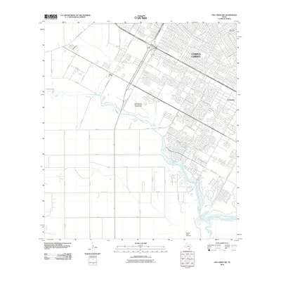
2010 Map of Oso Creek NW
USGS Topo · Published 2010About this map
Corpus Christi expansion dominates the northeast portion of this survey, where residential street grids meet the riparian corridor of Oso Creek. The landscape reflects a transition from high-density urban development to rural agricultural plots and ranchland. A significant military presence is anchored by Cabaniss Field Naval Outlying Landing Field near the center of the map, illustrating the region's importance to naval aviation training. To the south and west, the terrain opens into large tracts defined by a network of county roads like Co Rd 49 and Co Rd 33. In the southern reaches, more isolated landmarks appear, such as the Rancho Viejo Windmill, signaling the shift toward the coastal plains' traditional cattle and farming heritage before the more recent suburban encroachment seen at Gardendale.
Find a feature on this map
38 named features on this map. Tap any name to fly to it.
Don’t see what you’re looking for? This feature index may not catch every label — zoom into the map to look around manually.
Map Details
Editions of this 2010 Oso Creek NW Map
This is the sole edition of this map. No revisions or reprints were ever made.
Other maps of this area

1924 · Petronilla
USGS Topo · 1:62,500

1925 · Robstown
USGS Topo · 1:62,500

1925 · Oso Creek
USGS Topo · 1:62,500

1925 · Corpus Christi
USGS Topo · 1:62,500

1950 · Corpus Christi
USGS Topo · 1:250,000

1951 · Portland
USGS Topo · 1:24,000

1951 · Corpus Christi
USGS Topo · 1:24,000

1951 · Corpus Christi
USGS Topo · 1:62,500

1951 · Oso Creek NW
USGS Topo · 1:24,000

1951 · Oso Creek NE
USGS Topo · 1:24,000