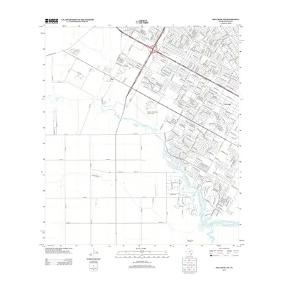
2013 Map of Oso Creek NW
USGS Topo · Published 2013About this map
Cabaniss Field Naval Outlying Field occupies a central position on this coastal Texas landscape, marking the intersection of military history and modern urban sprawl. The map captures a transition between the established street grids of Gardendale and the expansive rural tracts still defined by long-standing county roads and farm-to-market routes. Along the banks of Oso Cr, the terrain moves from dense residential development into more open territory, where features like the Rancho Viejo Windmill reflect the area's agricultural heritage. The infrastructure is a mix of historical transit lines like Old Brownsville Rd and newer residential arteries such as Rabbit Run Dr. This survey provides a clear look at the spatial relationship between the naval facility and the burgeoning suburban neighborhoods on the outskirts of Corpus Christi.
Find a feature on this map
313 named features on this map. Tap any name to fly to it.
Don’t see what you’re looking for? This feature index may not catch every label — zoom into the map to look around manually.
Map Details
Editions of this 2013 Oso Creek NW Map
This is the sole edition of this map. No revisions or reprints were ever made.
Other maps of this area

1924 · Petronilla
USGS Topo · 1:62,500

1925 · Robstown
USGS Topo · 1:62,500

1925 · Oso Creek
USGS Topo · 1:62,500

1925 · Corpus Christi
USGS Topo · 1:62,500

1950 · Corpus Christi
USGS Topo · 1:250,000

1951 · Portland
USGS Topo · 1:24,000

1951 · Corpus Christi
USGS Topo · 1:24,000

1951 · Corpus Christi
USGS Topo · 1:62,500

1951 · Oso Creek NW
USGS Topo · 1:24,000

1951 · Oso Creek NE
USGS Topo · 1:24,000