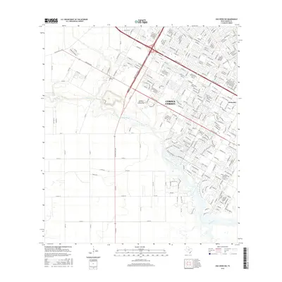
2016 Map of Oso Creek NW
USGS Topo · Published 2016About this map
Cabaniss Field Naval Outlying Field and the winding course of Oso Creek define this landscape on the southwestern edge of Corpus Christi. The 2016 survey illustrates the extensive suburban expansion and infrastructure developments typical of the era, with modern residential networks like Gardendale contrasting against older thoroughfares such as Old Brownsville Rd. High-traffic corridors including Saratoga Blvd and S Padre Island Dr facilitate the city's outward growth, while the southern portion of the map remains more open with large parcels and grid-based rural roads.
Find a feature on this map
42 named features on this map. Tap any name to fly to it.
Don’t see what you’re looking for? This feature index may not catch every label — zoom into the map to look around manually.
Map Details
Editions of this 2016 Oso Creek NW Map
This is the sole edition of this map. No revisions or reprints were ever made.
Other maps of this area

1924 · Petronilla
USGS Topo · 1:62,500

1925 · Robstown
USGS Topo · 1:62,500

1925 · Oso Creek
USGS Topo · 1:62,500

1925 · Corpus Christi
USGS Topo · 1:62,500

1950 · Corpus Christi
USGS Topo · 1:250,000

1951 · Portland
USGS Topo · 1:24,000

1951 · Corpus Christi
USGS Topo · 1:24,000

1951 · Corpus Christi
USGS Topo · 1:62,500

1951 · Oso Creek NW
USGS Topo · 1:24,000

1951 · Oso Creek NE
USGS Topo · 1:24,000