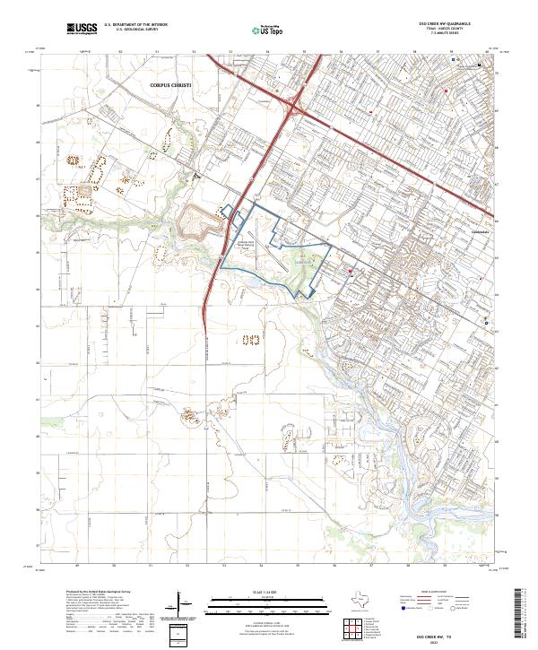
2023 Map of Oso Creek NW
USGS Topo · Published 2023About this map
The suburban southern reaches of Corpus Christi define this landscape, where the meandering course of Oso Creek cuts through a dense network of residential streets and arterial highways. Military history is central to this area, anchored by Alf Cabaniss and the Cabaniss Field Naval Outlying Field, installations that have long shaped the local development pattern. To the east, the community of Gardendale sits near the crossing of S Padre Island Dr and the Crosstown Expy, reflecting the mid-to-late 20th-century expansion of the city's infrastructure. These major thoroughfares create a sharp contrast with the natural drainage of the creek, which remains a primary geographic marker for residents in neighborhoods bordering Parkway Presbyterian Church Columbarium and the surrounding coastal plains of Nueces County.
Find a feature on this map
239 named features on this map. Tap any name to fly to it.
Don’t see what you’re looking for? This feature index may not catch every label — zoom into the map to look around manually.
Map Details
Editions of this 2023 Oso Creek NW Map
This is the sole edition of this map. No revisions or reprints were ever made.
Other maps of this area

1924 · Petronilla
USGS Topo · 1:62,500

1925 · Robstown
USGS Topo · 1:62,500

1925 · Oso Creek
USGS Topo · 1:62,500

1925 · Corpus Christi
USGS Topo · 1:62,500

1950 · Corpus Christi
USGS Topo · 1:250,000

1951 · Portland
USGS Topo · 1:24,000

1951 · Corpus Christi
USGS Topo · 1:24,000

1951 · Corpus Christi
USGS Topo · 1:62,500

1951 · Oso Creek NW
USGS Topo · 1:24,000

1951 · Oso Creek NE
USGS Topo · 1:24,000