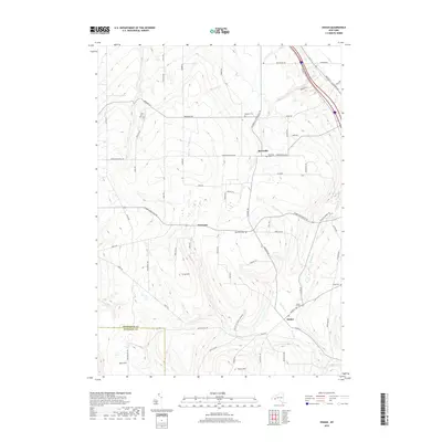
2019 Map of Ossian
USGS Topo · Published 2019About this map
Byersville and Westview anchor a landscape defined by rolling agricultural uplands and steep creek drainages along the border of Livingston Co and Allegany Co. The settlement pattern follows the contours of the land, with winding roads like Kysorville Byersville Rd and Nunda-Byersville Rd connecting small hamlets and family farmsteads. Genealogical interest is particularly high due to the density of well-preserved burial grounds, including Byersville Cem, Oaklawn Cem, and the remote Wood Cem located near the eastern quadrangle boundary.
Find a feature on this map
71 named features on this map. Tap any name to fly to it.
Don’t see what you’re looking for? This feature index may not catch every label — zoom into the map to look around manually.
Map Details
Editions of this 2019 Ossian Map
This is the sole edition of this map. No revisions or reprints were ever made.
Other maps of this area

1902 · Wayland
USGS Topo · 1:62,500

1904 · Wayland
USGS Topo · 1:62,500

1905 · Nunda
USGS Topo · 1:62,500

1915 · Hornell
USGS Topo · 1:62,500

1916 · Canaseraga
USGS Topo · 1:62,500

1918 · Hornell
USGS Topo · 1:62,500

1940 · Canaseraga
USGS Topo · 1:62,500

1942 · Dansville
USGS Topo · 1:31,680

1942 · Conesus
USGS Topo · 1:31,680

1943 · Mount Morris
USGS Topo · 1:24,000