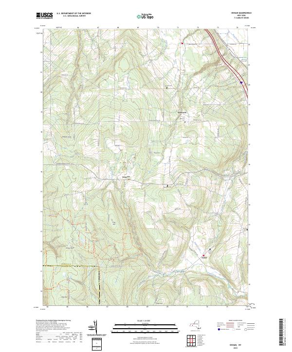
2023 Map of Ossian
USGS Topo · Published 2023About this map
Byersville and Westview anchor this agricultural and forested pocket of New York, where the Livingston Co Allegany Co line marks the southern boundary. The landscape is defined by steep gullies and high ridges, including Wildcat Gully and Frog Hill, which descend into the valley of Sugar Creek. For genealogists and local historians, the map provides precise locations for several burial grounds, such as Ossian Center Cem and Oaklawn Cem, which are often the only remaining markers of nineteenth-century settlement clusters. A complex network of recreation paths, including the Finger Lakes Trl and various color-coded routes like the Blue Trl, winds through the southern hills, reflecting the area's modern role as a hub for outdoor transition. Rural roads like Nunda-Dansville Rd and Dannack Hill Rd follow the natural contours of the highlands, connecting scattered farmsteads and isolated valleys.
Find a feature on this map
86 named features on this map. Tap any name to fly to it.
Don’t see what you’re looking for? This feature index may not catch every label — zoom into the map to look around manually.
Map Details
Editions of this 2023 Ossian Map
This is the sole edition of this map. No revisions or reprints were ever made.
Other maps of this area

1902 · Wayland
USGS Topo · 1:62,500

1904 · Wayland
USGS Topo · 1:62,500

1905 · Nunda
USGS Topo · 1:62,500

1915 · Hornell
USGS Topo · 1:62,500

1916 · Canaseraga
USGS Topo · 1:62,500

1918 · Hornell
USGS Topo · 1:62,500

1940 · Canaseraga
USGS Topo · 1:62,500

1942 · Dansville
USGS Topo · 1:31,680

1942 · Conesus
USGS Topo · 1:31,680

1943 · Mount Morris
USGS Topo · 1:24,000