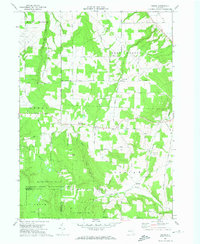
1972 Map of Ossian
USGS Topo · Published 1974About this map
Ossian and the high ridges of Rattlesnake Hill define this rural landscape on the border of Livingston and Allegany Counties. In the early 1970s, this area remained largely defined by upland agriculture and conservation, featuring the Wildlife State Management Area and extensive tracts of the State Reforestation Area. Small hamlets like Byersville and Westview provide focal points for local history, while the map preserves the locations of several community landmarks including the Red School and Oaklawn Cem. Drainage patterns are clearly marked by the flow of Sugar Creek and Bradner Creek through the eastern valleys, contrasting with the steep terrain of Wildcat Gully in the north. This survey captures a specific era of land management and rural settlement before modern changes to the forest and road networks.
Find a feature on this map
49 named features on this map. Tap any name to fly to it.
Don’t see what you’re looking for? This feature index may not catch every label — zoom into the map to look around manually.
Map Details
Editions of this 1972 Ossian Map
This is the sole edition of this map. No revisions or reprints were ever made.
Other maps of this area

1902 · Wayland
USGS Topo · 1:62,500

1904 · Wayland
USGS Topo · 1:62,500

1905 · Nunda
USGS Topo · 1:62,500

1915 · Hornell
USGS Topo · 1:62,500

1916 · Canaseraga
USGS Topo · 1:62,500

1918 · Hornell
USGS Topo · 1:62,500

1940 · Canaseraga
USGS Topo · 1:62,500

1942 · Dansville
USGS Topo · 1:31,680

1942 · Conesus
USGS Topo · 1:31,680

1943 · Mount Morris
USGS Topo · 1:24,000