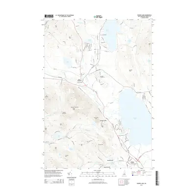
2015 Map of Ossipee Lake
USGS Topo · Published 2015About this map
Ossipee Lake dominates this Carroll County landscape, serving as the central hub for a network of waterways including the Bearcamp River, Lovell River, and Pine River. The map details the transition from the high peaks of the Ossipee Mountains and Nickerson Mountains in the west down to the developed shorelines and village centers in the east. Historic crossing points and small communities like West Ossipee, Moultonville, and Center Ossipee are shown alongside local landmarks such as Whittier Bridge. This survey reflects the modern topography of a classic New Hampshire lakeside region, where residential development along roads like E Shore Dr and W Shore Dr at Silver Lake meets the protected forests of the surrounding heights, including Grant Peak and Mt Whittier.
Find a feature on this map
131 named features on this map. Tap any name to fly to it.
Don’t see what you’re looking for? This feature index may not catch every label — zoom into the map to look around manually.
Map Details
Editions of this 2015 Ossipee Lake Map
This is the sole edition of this map. No revisions or reprints were ever made.
Other maps of this area

1909 · Winnepesaukee
USGS Topo · 1:62,500

1928 · Wolfeboro
USGS Topo · 1:62,500

1930 · Ossipee Lake
USGS Topo · 1:62,500

1931 · Mt. Chocorua
USGS Topo · 1:62,500

1949 · Portland
USGS Topo · 1:250,000

1956 · Winnipesaukee
USGS Topo · 1:62,500

1956 · Portland
USGS Topo · 1:250,000

1958 · Ossipee Lake
USGS Topo · 1:62,500

1958 · Wolfeboro
USGS Topo · 1:62,500

1958 · Mt. Chocorua
USGS Topo · 1:62,500