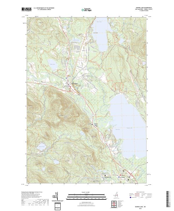
2024 Map of Ossipee Lake
USGS Topo · Published 2024About this map
Ossipee Lake and its surrounding mountain ranges anchor this Carroll County landscape, where the Bearcamp River and Lovell River meet the water's edge. The settlement pattern is concentrated in historic nodes like West Ossipee, Center Ossipee, and Moultonville, each maintaining its own distinct character alongside numerous small family burial grounds. For genealogists, the map is particularly rich, identifying the Ham Cem, Grant Hill Cem, and the Moultonville United Methodist Church Cem.
Find a feature on this map
137 named features on this map. Tap any name to fly to it.
Don’t see what you’re looking for? This feature index may not catch every label — zoom into the map to look around manually.
Map Details
Editions of this 2024 Ossipee Lake Map
This is the sole edition of this map. No revisions or reprints were ever made.
Other maps of this area

1909 · Winnepesaukee
USGS Topo · 1:62,500

1928 · Wolfeboro
USGS Topo · 1:62,500

1930 · Ossipee Lake
USGS Topo · 1:62,500

1931 · Mt. Chocorua
USGS Topo · 1:62,500

1949 · Portland
USGS Topo · 1:250,000

1956 · Winnipesaukee
USGS Topo · 1:62,500

1956 · Portland
USGS Topo · 1:250,000

1958 · Ossipee Lake
USGS Topo · 1:62,500

1958 · Wolfeboro
USGS Topo · 1:62,500

1958 · Mt. Chocorua
USGS Topo · 1:62,500