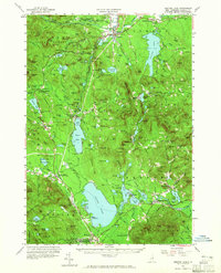
1958 Map of Ossipee Lake
USGS Topo · Published 1965About this map
The Swift River and Saco River valleys define this mid-century landscape in the White Mountain National Forest, where the transition from high-elevation granite ledges to the glacial lake basins of the Ossipee region is clearly marked. The rail-oriented layout of the late 1950s is still evident at Silver Lake (Madison Sta) and West Ossipee (Mt Whittier Sta), reflecting the importance of the Boston and Maine Railroad to these White Mountain foothills.
Find a feature on this map
162 named features on this map. Tap any name to fly to it.
Don’t see what you’re looking for? This feature index may not catch every label — zoom into the map to look around manually.
Map Details
Editions of this 1958 Ossipee Lake Map
4 editions found

Other maps of this area

1891 · Newfield
USGS Topo · 1:62,500

1893 · Newfield
USGS Topo · 1:62,500

1894 · North Conway
USGS Topo · 1:62,500

1895 · Crawford Notch
USGS Topo · 1:62,500

1896 · Crawford Notch
USGS Topo · 1:62,500

1896 · North Conway
USGS Topo · 1:62,500

1909 · Winnepesaukee
USGS Topo · 1:62,500

1909 · Fryeburg
USGS Topo · 1:62,500

1910 · Kezar Falls
USGS Topo · 1:48,000

1911 · Fryeburg
USGS Topo · 1:62,500