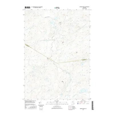
2016 Map of Oswegatchie SE
USGS Topo · Published 2016About this map
The Middle Branch Oswegatchie River meanders through this section of the Adirondack Park Preserve, defining a landscape dominated by complex waterways and high peaks. This 2016 survey documents a wilderness area where the boundary between St. Lawrence and Herkimer Counties cuts through dense terrain. Notable elevations such as Streeter Mtn, Alder Bed Mtn, and Maple Hill overlook a network of glacial water bodies, including Streeter Lake and the circular Massawepie Pond. The drainage patterns are clearly visible through features like the Little Otter Pond Outlet and Sand Lake Outlet, showing the hydraulic connection between the numerous ponds and marshes. This map is an essential reference for understanding the modern topographic state of these protected North Country lands, tracing named creeks like Mullins Marsh Cr and Pins Cr through the forest.
Find a feature on this map
44 named features on this map. Tap any name to fly to it.
Don’t see what you’re looking for? This feature index may not catch every label — zoom into the map to look around manually.
Map Details
Editions of this 2016 Oswegatchie SE Map
This is the sole edition of this map. No revisions or reprints were ever made.
Other maps of this area

1903 · Big Moose
USGS Topo · 1:62,500

1912 · Number Four
USGS Topo · 1:62,500

1915 · Number Four
USGS Topo · 1:62,500

1916 · Oswegatchie
USGS Topo · 1:62,500

1918 · Oswegatchie
USGS Topo · 1:62,500

1919 · Cranberry Lake
USGS Topo · 1:62,500

1921 · Cranberry Lake
USGS Topo · 1:62,500

1931 · Cranberry Lake
USGS Topo · 1:62,500

1948 · Ogdensburg
USGS Topo · 1:250,000

1950 · Utica
USGS Topo · 1:250,000