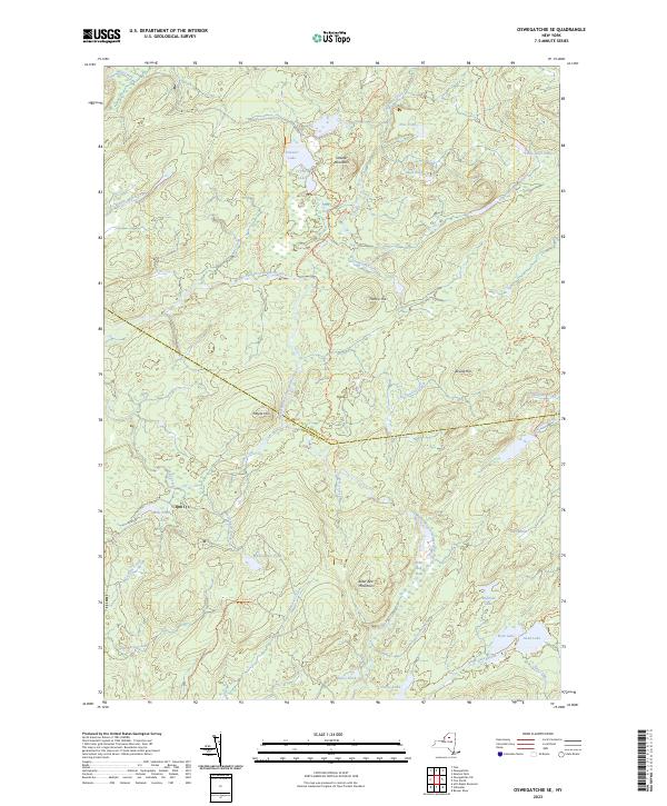
2023 Map of Oswegatchie SE
USGS Topo · Published 2023About this map
The Middle Branch Oswegatchie River defines the hydrological character of this remote borderland between St. Lawrence and Herkimer counties. This landscape is a complex network of glacial ponds and wetlands, where high-elevation features like Streeter Mountain and Alder Bed Mountain rise above significant water bodies including Streeter Lake and Massawepie Pond. The map documents a territory primarily navigated by foot and primitive trail rather than paved roads, evidenced by the presence of the Keck Trl, Buck Pond Trl, and Francis Hill Road Trl.
Find a feature on this map
45 named features on this map. Tap any name to fly to it.
Don’t see what you’re looking for? This feature index may not catch every label — zoom into the map to look around manually.
Map Details
Editions of this 2023 Oswegatchie SE Map
This is the sole edition of this map. No revisions or reprints were ever made.
Other maps of this area

1903 · Big Moose
USGS Topo · 1:62,500

1912 · Number Four
USGS Topo · 1:62,500

1915 · Number Four
USGS Topo · 1:62,500

1916 · Oswegatchie
USGS Topo · 1:62,500

1918 · Oswegatchie
USGS Topo · 1:62,500

1919 · Cranberry Lake
USGS Topo · 1:62,500

1921 · Cranberry Lake
USGS Topo · 1:62,500

1931 · Cranberry Lake
USGS Topo · 1:62,500

1948 · Ogdensburg
USGS Topo · 1:250,000

1950 · Utica
USGS Topo · 1:250,000