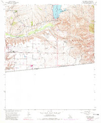
1955 Map of Otay Mesa
USGS Topo · Published 1982About this map
The international border with Mexico anchors the southern edge of this landscape, where Otay Mesa transitions into the rugged slopes of the San Ysidro Mountains. Military and aviation infrastructure dominates the central mesa, defined by the San Diego Naval Auxiliary Air Station and the Brown Field complex, including the nearby Brown Field Bombing Range. The northern terrain is shaped by the Otay River valley and the massive Otay Reservoir, held by the Savage Dam. This 1955 survey captures the region's agricultural roots alongside its defense-era expansion. Scattered family-named holdings like Otay Ranch, Bird Ranch, and Kuebler Ranch persist even as an extensive Aqueduct and Filtration Plant signal the growing industrial water needs of the San Diego area. Local landmarks such as the Alta School and the Coronado Wye provide specific points of interest for genealogists tracing the early development of this borderland community.
Find a feature on this map
35 named features on this map. Tap any name to fly to it.
Don’t see what you’re looking for? This feature index may not catch every label — zoom into the map to look around manually.
Map Details
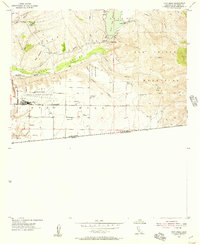
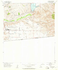
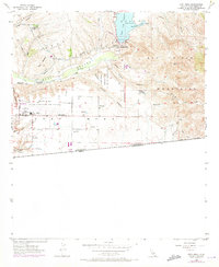
Editions of this 1955 Otay Mesa Map
4 editions found
Other maps of this area

1903 · Cuyamaca
USGS Topo · 1:125,000

1904 · San Diego
USGS Topo · 1:62,500

1904 · Southern California Sheet No. 2
USGS Topo · 1:250,000

1930 · San Diego
USGS Topo · 1:62,500
1943 · San Ysidro
USGS Topo · 1:31,680

1943 · Jamul
USGS Topo · 1:62,500
1944 · National City
USGS Topo · 1:31,680

1950 · San Diego
USGS Topo · 1:250,000
1953 · San Ysidro
USGS Topo · 1:24,000
1953 · National City
USGS Topo · 1:24,000