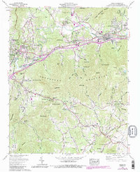
1962 Map of Oteen
USGS Topo · Published 1990About this map
The Swannanoa River corridor east of Asheville serves as the primary artery for settlement and industry in this 1962 photogrammetric revision. The landscape is defined by the Southern Railway and the Blue Ridge Parkway, which snake through the Swannanoa Mountains. This era shows a community in transition, balancing established institutions like Warren Wilson College and the Veterans Administration Hospital with mid-century roadside culture, exemplified by the Oteen Drive-in Theater.
Find a feature on this map
77 named features on this map. Tap any name to fly to it.
Don’t see what you’re looking for? This feature index may not catch every label — zoom into the map to look around manually.
Map Details
Editions of this 1962 Oteen Map
2 editions found
Other maps of this area

1894 · Asheville
USGS Topo · 1:125,000

1900 · Mount Mitchell
USGS Topo · 1:125,000

1901 · Asheville
USGS Topo · 1:125,000

1902 · Mount Mitchell
USGS Topo · 1:125,000

1905 · Pisgah
USGS Topo · 1:125,000

1906 · Pisgah
USGS Topo · 1:125,000

1907 · Saluda
USGS Topo · 1:125,000

1935 · Montreat
USGS Topo · 1:24,000

1935 · Batcave
USGS Topo · 1:24,000

1935 · Black Mountain
USGS Topo · 1:24,000