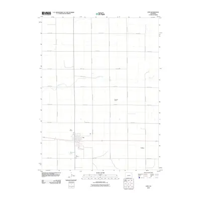
2010 Map of Otis
USGS Topo · Published 2010About this map
Otis serves as the primary hub of this high plains landscape in Washington County, defined by a rigid grid of agricultural roads and the meandering path of Surveyor Creek. The town is situated at a junction of transportation, where the street grid including S Washington St meets regional routes. Beyond the immediate town limits, the landscape is characterized by its rural infrastructure, including Otis Airport and Stansfield Airport, which highlight the area's reliance on aviation in a sparsely populated region. For those researching local history, the Otis Cemetery and the settlement of Calhoun provide specific points of interest for tracing family roots and historical land use. The water features, though limited, are significant landmarks in this arid environment, most notably Haverland Pond and the branching drainage of the creek.
Find a feature on this map
21 named features on this map. Tap any name to fly to it.
Don’t see what you’re looking for? This feature index may not catch every label — zoom into the map to look around manually.
Map Details
Editions of this 2010 Otis Map
This is the sole edition of this map. No revisions or reprints were ever made.
Other maps of this area

1954 · Sterling
USGS Topo · 1:250,000

1958 · Sterling
USGS Topo · 1:250,000

1972 · Otis
USGS Topo · 1:24,000

1972 · Hyde
USGS Topo · 1:24,000

1972 · Lone Star
USGS Topo · 1:24,000

1972 · Snyder Lake
USGS Topo · 1:24,000

1972 · Otis SE
USGS Topo · 1:24,000

1972 · Burdett
USGS Topo · 1:24,000

1973 · Platner
USGS Topo · 1:24,000

1973 · Buffalo Springs Ranch SE
USGS Topo · 1:24,000