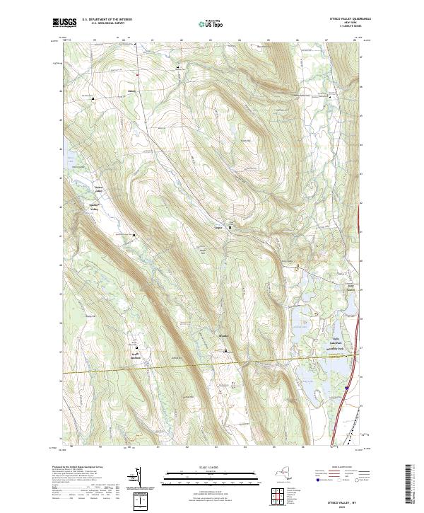
2023 Map of Otisco Valley
USGS Topo · Published 2023About this map
Otisco Lake and the steep ridges of the Finger Lakes region define this landscape at the border of Onondaga and Cortland counties. The area is characterized by high-elevation hills like Dutch Hill and Preble Hill, which are deeply incised by narrow gorges such as Rattlesnake Gulf and Emerson Gulf. This 2023 survey documents a predominantly rural and residential character, where long-established hamlets like Vesper and Bromley are connected by a network of county roads. Genealogists will find a high density of burial grounds throughout the townships, including Saint Patricks Cem and the Cold Brook Valley Cem. Further east, the terrain descends into the Tully Valley, where the glacial kettle lakes Song Lake and Crooked Lake serve as centers for communities like Tully Lake Park and Assembly Park.
Find a feature on this map
97 named features on this map. Tap any name to fly to it.
Don’t see what you’re looking for? This feature index may not catch every label — zoom into the map to look around manually.
Map Details
Editions of this 2023 Otisco Valley Map
This is the sole edition of this map. No revisions or reprints were ever made.
Other maps of this area

1898 · Moravia
USGS Topo · 1:62,500

1899 · Skaneateles
USGS Topo · 1:62,500

1900 · Tully
USGS Topo · 1:62,500

1902 · Skaneateles
USGS Topo · 1:62,500

1902 · Moravia
USGS Topo · 1:62,500

1903 · Cortland
USGS Topo · 1:62,500

1943 · South Onondaga
USGS Topo · 1:31,680

1943 · Spafford
USGS Topo · 1:31,680

1943 · Jamesville
USGS Topo · 1:31,680

1943 · Otisco Valley
USGS Topo · 1:31,680