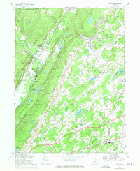
1969 Map of Otisville
USGS Topo · Published 1971About this map
The Shawangunk Mountains dominate this 1969 landscape, creating a dramatic physical divide between the valley of the Basher Kill and the upland reaches of Mount Hope. Along the eastern slopes, the Erie Lackawanna Railroad winds through the village of Otisville, passing near the substantial campus of the State Training School for Boys. To the west, the Neversink River flows through Cuddebackville and Myers Grove, where the terrain flattens into a patchwork of riverfront settlements and gravel operations.
Find a feature on this map
72 named features on this map. Tap any name to fly to it.
Don’t see what you’re looking for? This feature index may not catch every label — zoom into the map to look around manually.
Map Details
Editions of this 1969 Otisville Map
2 editions found
Other maps of this area

1904 · Ellenville
USGS Topo · 1:62,500

1906 · Ellenville
USGS Topo · 1:62,500

1906 · Port Jervis
USGS Topo · 1:62,500

1906 · Goshen
USGS Topo · 1:62,500

1908 · Goshen
USGS Topo · 1:62,500

1908 · Port Jervis
USGS Topo · 1:62,500

1909 · Monticello
USGS Topo · 1:62,500

1911 · Monticello
USGS Topo · 1:62,500

1938 · Goshen
USGS Topo · 1:62,500

1942 · Pine Island
USGS Topo · 1:24,000