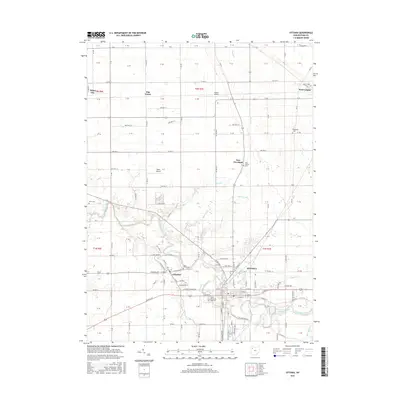
2016 Map of Ottawa
USGS Topo · Published 2016About this map
The Blanchard River defines the landscape of Putnam County in this 2016 survey, winding through the heart of Ottawa and past the nearby village of Glandorf. This region of Northwest Ohio is characterized by its organized grid of township roads and agricultural drainage systems like Lammer Ditch and Black Ditch. The map provides detailed local-history data through its recording of numerous rural burial grounds, including McConnel Cem and Crow Cem, alongside religious landmarks like the Saints Peter and Paul Cem. Aviation infrastructure is represented by small local strips such as Agner Airport and Ruhe's Airport. Within the municipal limits of Ottawa, the Ottawa Upground Reservoir and the intersection of Main St and S Agner St show the modern configuration of this county seat.
Find a feature on this map
64 named features on this map. Tap any name to fly to it.
Don’t see what you’re looking for? This feature index may not catch every label — zoom into the map to look around manually.
Map Details
Editions of this 2016 Ottawa Map
This is the sole edition of this map. No revisions or reprints were ever made.
Other maps of this area

1906 · Columbus Grove
USGS Topo · 1:62,500

1907 · Bluffton
USGS Topo · 1:62,500

1908 · Columbus Grove
USGS Topo · 1:62,500

1908 · Ottawa
USGS Topo · 1:62,500

1950 · Marion
USGS Topo · 1:250,000

1953 · Fort Wayne
USGS Topo · 1:250,000

1953 · Muncie
USGS Topo · 1:250,000

1956 · Muncie
USGS Topo · 1:250,000

1956 · Fort Wayne
USGS Topo · 1:250,000

1956 · Toledo
USGS Topo · 1:250,000