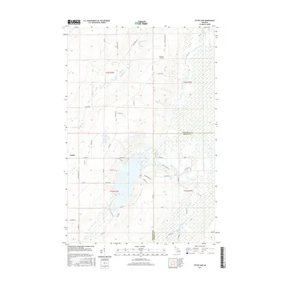
2017 Map of Otter Lake
USGS Topo · Published 2017About this map
Otter Lake and the winding course of the Otter River define this section of the Upper Peninsula on the border of Houghton and Baraga counties. The landscape is marked by a complex network of waterways, including the Sturgeon River and the Pike River, which flows past Pike River Landing. Small settlements like Tapiola are connected by a grid of named local roads that reflect the area's rural character and Finnish heritage, evident in names such as Hyppio Rd and Manninen Rd. Local history is anchored by the Kargi Cem and Askel Cem, situated near the eastern shores of the lake. The map illustrates a region where timber and water resources likely shaped the development of these isolated communities, showing the transition from dense forest and wetlands near Mud Lake to the more open river valleys.
Find a feature on this map
59 named features on this map. Tap any name to fly to it.
Don’t see what you’re looking for? This feature index may not catch every label — zoom into the map to look around manually.
Map Details
Editions of this 2017 Otter Lake Map
This is the sole edition of this map. No revisions or reprints were ever made.
Other maps of this area

1915 · Houghton
USGS Topo · 1:62,500

1946 · Chassell
USGS Topo · 1:24,000

1946 · South Range
USGS Topo · 1:24,000

1948 · South Range
USGS Topo · 1:24,000

1948 · Chassell
USGS Topo · 1:24,000

1954 · Keweenaw Bay
USGS Topo · 1:62,500

1954 · Point Mills
USGS Topo · 1:24,000

1954 · Pelkie
USGS Topo · 1:62,500

1954 · Houghton
USGS Topo · 1:62,500

1958 · Hancock
USGS Topo · 1:250,000