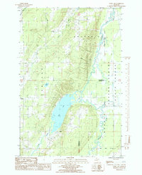
1985 Map of Otter Lake
USGS Topo · Published 1985About this map
Otter Lake and its surrounding wetlands form the center of this rural landscape on the border of Baraga County. In the mid-1980s, this area of the Upper Peninsula was characterized by small settlements like Tapiola and Askel, where winding roads and utility corridors such as a pipeline and powerline cut through the timbered terrain of the Copper State Forest. A network of water defines the geography, with the Otter River, Pike River, and the meandering Sturgeon River all converging in this low-lying basin.
Find a feature on this map
21 named features on this map. Tap any name to fly to it.
Don’t see what you’re looking for? This feature index may not catch every label — zoom into the map to look around manually.
Map Details
Editions of this 1985 Otter Lake Map
This is the sole edition of this map. No revisions or reprints were ever made.
Other maps of this area

1915 · Houghton
USGS Topo · 1:62,500

1946 · Chassell
USGS Topo · 1:24,000

1946 · South Range
USGS Topo · 1:24,000

1948 · South Range
USGS Topo · 1:24,000

1948 · Chassell
USGS Topo · 1:24,000

1954 · Keweenaw Bay
USGS Topo · 1:62,500

1954 · Point Mills
USGS Topo · 1:24,000

1954 · Pelkie
USGS Topo · 1:62,500

1954 · Houghton
USGS Topo · 1:62,500

1958 · Hancock
USGS Topo · 1:250,000