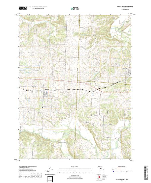
2021 Map of Otterville West
USGS Topo · Published 2021About this map
Smithton and the western outskirts of Otterville anchor this landscape along the border of Pettis, Cooper, and Morgan counties. The terrain is defined by a dense network of tributaries including Flat Creek, Shaver Cr, and the winding Lamine River to the northeast. Transportation history is deeply etched into the modern topography, seen clearly in the path of the Katy Trl, which follows a former rail corridor across the northern section of the map.
Find a feature on this map
78 named features on this map. Tap any name to fly to it.
Don’t see what you’re looking for? This feature index may not catch every label — zoom into the map to look around manually.
Map Details
Editions of this 2021 Otterville West Map
This is the sole edition of this map. No revisions or reprints were ever made.
Other maps of this area

1887 · Sedalia
USGS Topo · 1:125,000

1888 · Boonville
USGS Topo · 1:125,000

1894 · Sedalia
USGS Topo · 1:125,000

1944 · Sedalia East
USGS Topo · 1:24,000

1946 · Sedalia East
USGS Topo · 1:24,000

1947 · Jefferson City
USGS Topo · 1:250,000

1953 · Pilot Grove South
USGS Topo · 1:24,000
1953 · Florence
USGS Topo · 1:24,000
1953 · Otterville East
USGS Topo · 1:24,000
1953 · Clifton City
USGS Topo · 1:24,000