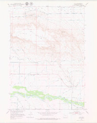
1951 Map of Otto
USGS Topo · Published 1979About this map
The Greybull River valley serves as the lifeblood of this Big Horn County landscape, where an intricate network of irrigation projects transformed the arid basin. Water management is the dominant theme, evidenced by the South Lateral Bench Canal, Highline Ditch, and Farmers Canal which snake along the contours of the terrain. These systems supported the small community of Otto and the nearby settlement of Webster, creating a fertile corridor beneath the shadow of Table Mountain.
Find a feature on this map
23 named features on this map. Tap any name to fly to it.
Don’t see what you’re looking for? This feature index may not catch every label — zoom into the map to look around manually.
Map Details
Editions of this 1951 Otto Map
2 editions found
Other maps of this area

1951 · Burlington
USGS Topo · 1:24,000

1951 · Sheep Mountain
USGS Topo · 1:24,000

1951 · Wardel Reservoir
USGS Topo · 1:24,000

1951 · Otto
USGS Topo · 1:24,000

1955 · Cody
USGS Topo · 1:250,000

1958 · Cody
USGS Topo · 1:250,000

1962 · Cody
USGS Topo · 1:250,000
1966 · Sheep Canyon
USGS Topo · 1:24,000
1966 · Gould Butte
USGS Topo · 1:24,000

1966 · Emblem SE
USGS Topo · 1:24,000