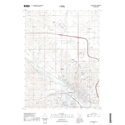
2018 Map of Ottumwa North
USGS Topo · Published 2018About this map
The Des Moines River bisects this landscape, carving a wide valley that defines the development of Ottumwa. Significant urban infrastructure is concentrated along the northern banks, including the rail-heavy corridor of Ottumwa Junction and the transit hub of Rutledge. A dense concentration of historical burial grounds, such as Ottumwa Cem, Hebrew Jewish Cem, and Calvary Cem, line the bluffs overlooking the river, providing a significant resource for genealogical research. To the north, the terrain shifts from industrial and residential blocks to the open expanses of the Ottumwa Regional Airport. The river itself is punctuated by Turkey Island, while numerous tributaries like Kettle Cr and Harrows Branch drain the surrounding hills, illustrating the hydrological network that supported the city's early 21st-century footprint.
Find a feature on this map
169 named features on this map. Tap any name to fly to it.
Don’t see what you’re looking for? This feature index may not catch every label — zoom into the map to look around manually.
Map Details
Editions of this 2018 Ottumwa North Map
This is the sole edition of this map. No revisions or reprints were ever made.
Other maps of this area

1954 · Centerville
USGS Topo · 1:250,000

1954 · Des Moines
USGS Topo · 1:250,000

1956 · Des Moines
USGS Topo · 1:250,000

1956 · Farson
USGS Topo · 1:24,000

1956 · Agency
USGS Topo · 1:24,000

1956 · Ottumwa North
USGS Topo · 1:62,500

1956 · Ottumwa South
USGS Topo · 1:24,000

1956 · Ottumwa South
USGS Topo · 1:62,500

1956 · Ottumwa North
USGS Topo · 1:24,000

1957 · Des Moines
USGS Topo · 1:250,000