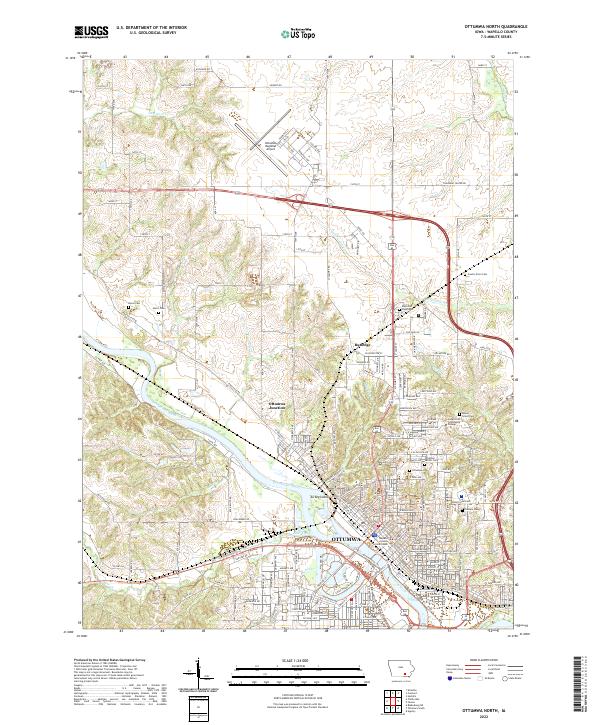
2022 Map of Ottumwa North
USGS Topo · Published 2022About this map
Ottumwa serves as the focal point of this 2022 survey, situated along the winding course of the Des Moines River. The map illustrates a dense collection of civic and cultural sites, including the Wapello County Courthouse and several significant burial grounds such as Ottumwa Jewish Cem, Mount Olivet Cem, and Calvary Cem. To the north, the Ottumwa Regional Airport and the outlying community of Rutledge show the continued reach of the city into the surrounding rural landscape of Wapello County.
Find a feature on this map
103 named features on this map. Tap any name to fly to it.
Don’t see what you’re looking for? This feature index may not catch every label — zoom into the map to look around manually.
Map Details
Editions of this 2022 Ottumwa North Map
This is the sole edition of this map. No revisions or reprints were ever made.
Other maps of this area

1954 · Centerville
USGS Topo · 1:250,000

1954 · Des Moines
USGS Topo · 1:250,000

1956 · Des Moines
USGS Topo · 1:250,000

1956 · Farson
USGS Topo · 1:24,000

1956 · Agency
USGS Topo · 1:24,000

1956 · Ottumwa North
USGS Topo · 1:62,500

1956 · Ottumwa South
USGS Topo · 1:24,000

1956 · Ottumwa South
USGS Topo · 1:62,500

1956 · Ottumwa North
USGS Topo · 1:24,000

1957 · Des Moines
USGS Topo · 1:250,000