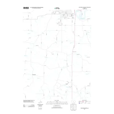
2013 Map of Ottumwa South
USGS Topo · Published 2013About this map
The Des Moines River winds through the northeast corner of this Iowa landscape, where the urban outskirts of Ottumwa transition into the agricultural and wooded terrain of Wapello County. The area is defined by a dense network of tributaries including Village Cr, Little Soap Cr, and Brush Cr that carve through the countryside. This 2013 survey shows the small settlement of Ormanville situated near the headwaters of Coon Cr, while the community of Carbon lies further south along the banks of Soap Cr. Educational and recreational land use is represented by Hickory Grove Camp and Forest Lake Camp, both located east of US Route 63. The map reveals how modern road grids like Copperhead Rd and Bluegrass Rd interact with the natural drainage patterns of the Des Moines River valley.
Find a feature on this map
90 named features on this map. Tap any name to fly to it.
Don’t see what you’re looking for? This feature index may not catch every label — zoom into the map to look around manually.
Map Details
Editions of this 2013 Ottumwa South Map
This is the sole edition of this map. No revisions or reprints were ever made.
Other maps of this area

1954 · Centerville
USGS Topo · 1:250,000

1954 · Des Moines
USGS Topo · 1:250,000

1956 · Des Moines
USGS Topo · 1:250,000

1956 · Farson
USGS Topo · 1:24,000

1956 · Agency
USGS Topo · 1:24,000

1956 · Ottumwa North
USGS Topo · 1:62,500

1956 · Ottumwa South
USGS Topo · 1:24,000

1956 · Ottumwa South
USGS Topo · 1:62,500

1956 · Ottumwa North
USGS Topo · 1:24,000

1957 · Des Moines
USGS Topo · 1:250,000