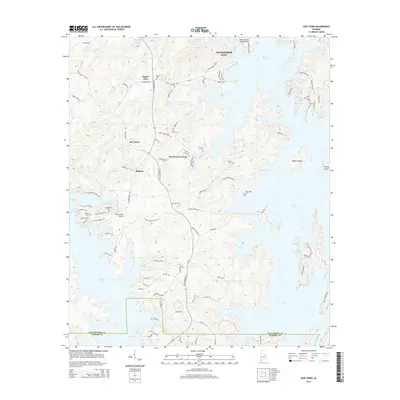
2014 Map of Our Town
USGS Topo · Published 2014About this map
Martin Lake dominates this Alabama landscape, its serpentine shoreline creating numerous peninsulas and secluded coves. This 21st-century documentation shows the developed character of the region, where infrastructure like the Willow Point Airport and the Robert Alston Russell Bridge facilitate access to residential enclaves and recreational lands. The map details a transition from the southern outskirts of Alexander City into the clustered communities of Our Town, Wind Creek Farms, and Bulgers. For the local historian, the map preserves the locations of several small burial grounds, including Friendship Cem and Liberty Cem, which sit near the lake's western edge. The presence of Woods Island and Youngs Island reflects the impact of the reservoir on the former valley topography, while the network of roads like State Highway 63 S shows the modern pulse of the Tallapoosa County and Elmore County borderlands.
Find a feature on this map
91 named features on this map. Tap any name to fly to it.
Don’t see what you’re looking for? This feature index may not catch every label — zoom into the map to look around manually.
Map Details
Editions of this 2014 Our Town Map
This is the sole edition of this map. No revisions or reprints were ever made.
Other maps of this area

1901 · Wetumpka
USGS Topo · 1:125,000

1901 · Wetumpka
USGS Topo · 1:62,500

1903 · Wetumpka
USGS Topo · 1:125,000

1906 · Dadeville
USGS Topo · 1:125,000

1953 · Montgomery
USGS Topo · 1:250,000

1955 · Phenix City
USGS Topo · 1:250,000

1956 · Montgomery
USGS Topo · 1:250,000

1957 · Phenix City
USGS Topo · 1:250,000

1957 · Montgomery
USGS Topo · 1:250,000

1958 · Phenix City
USGS Topo · 1:250,000