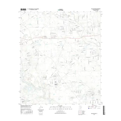
2016 Map of Outlaw Pond
USGS Topo · Published 2016About this map
Porter Heights serves as a primary residential hub in this corner of Montgomery County, where the transition from rural woodlands to suburban development is underway. The landscape is defined by an extensive network of small, named water bodies such as Outlaw Pond, Sour Pine Pond, and Humble Club Lake, reflecting the low-lying, ponded drainage systems common north of Houston. To the south, Black Slough and Woodsons Gully course through the terrain, indicating the complex hydrology of the San Jacinto River watershed. Local history is anchored by the Freeman Cem and Vick Cem, while the North Houston Airport marks the area's role in regional transportation. The map reveals a dense web of county roads and family-named routes like Tommy Smith Rd and Vick Cemetery Rd, tracing the legacy of long-standing local property lines and community clusters.
Find a feature on this map
220 named features on this map. Tap any name to fly to it.
Don’t see what you’re looking for? This feature index may not catch every label — zoom into the map to look around manually.
Map Details
Editions of this 2016 Outlaw Pond Map
This is the sole edition of this map. No revisions or reprints were ever made.
Other maps of this area

1916 · Moonshine Hill
USGS Topo · 1:24,000

1916 · Spring
USGS Topo · 1:24,000

1919 · Weeden
USGS Topo · 1:31,680

1920 · Spring
USGS Topo · 1:31,680

1920 · Moonshine Hill
USGS Topo · 1:31,680

1954 · Beaumont
USGS Topo · 1:250,000

1957 · Beaumont
USGS Topo · 1:250,000

1958 · Conroe
USGS Topo · 1:24,000

1958 · Fostoria
USGS Topo · 1:24,000

1959 · Outlaw Pond
USGS Topo · 1:24,000