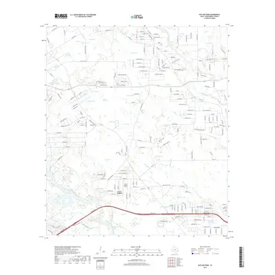
2019 Map of Outlaw Pond
USGS Topo · Published 2019About this map
Porter Heights serves as a primary residential hub in this corner of Montgomery County, where the landscape is defined by a dense network of small ponds and creek drainages. The naming conventions of these water bodies, such as Outlaw Pond, Sour Pine Pond, and Big Buck Pond, suggest a history of local land use tied to timber and hunting. Aviation and transportation interests are anchored by the North Houston Airport and the modern path of the Grand Pkwy in the southern portion of the quadrangle. Genealogists will find interest in the documented locations of Freeman Cem and Vick Cem, which preserve family names in an area experiencing significant suburban growth. The map illustrates a transition from established rural properties and recreational spots like Humble Club Lake to increasing infrastructure development near Dry Cr and Caney Cr.
Find a feature on this map
223 named features on this map. Tap any name to fly to it.
Don’t see what you’re looking for? This feature index may not catch every label — zoom into the map to look around manually.
Map Details
Editions of this 2019 Outlaw Pond Map
This is the sole edition of this map. No revisions or reprints were ever made.
Other maps of this area

1916 · Moonshine Hill
USGS Topo · 1:24,000

1916 · Spring
USGS Topo · 1:24,000

1919 · Weeden
USGS Topo · 1:31,680

1920 · Spring
USGS Topo · 1:31,680

1920 · Moonshine Hill
USGS Topo · 1:31,680

1954 · Beaumont
USGS Topo · 1:250,000

1957 · Beaumont
USGS Topo · 1:250,000

1958 · Conroe
USGS Topo · 1:24,000

1958 · Fostoria
USGS Topo · 1:24,000

1959 · Outlaw Pond
USGS Topo · 1:24,000