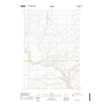
2020 Map of Outlet Falls
USGS Topo · Published 2020About this map
Klickitat River carves a significant course through this landscape along the boundary between Yakima and Klickitat counties. The terrain is defined by dramatic elevation changes, notably the namesake Outlet Falls where Outlet Cr drops toward the river valley. The map reveals a pattern of rural industry and access, with numerous Bureau of Indian Affairs routes like Bia RD 223 and Bia RD 227 crisscrossing the high ground of Cedar Valley and the slopes of Klose Butte. Settlement is sparse, represented by isolated locations such as the small valley floor at Borde Flats and the water source at Indian Ford Springs. A Mill Pond near the junction of Glenwood Hwy and Fish Hatchery Rd suggests historical timber or agricultural activity in the flats south of the main river canyon.
Find a feature on this map
32 named features on this map. Tap any name to fly to it.
Don’t see what you’re looking for? This feature index may not catch every label — zoom into the map to look around manually.
Map Details
Editions of this 2020 Outlet Falls Map
This is the sole edition of this map. No revisions or reprints were ever made.
Other maps of this area

1904 · Mount Adams
USGS Topo · 1:125,000

1907 · Mount Adams
USGS Topo · 1:125,000

1934 · The Dalles
USGS Topo · 1:125,000

1950 · Yakima
USGS Topo · 1:250,000

1953 · The Dalles
USGS Topo · 1:250,000

1956 · The Dalles
USGS Topo · 1:250,000

1957 · The Dalles
USGS Topo · 1:250,000

1957 · Klickitat
USGS Topo · 1:62,500

1957 · Husum
USGS Topo · 1:62,500

1958 · Yakima
USGS Topo · 1:250,000