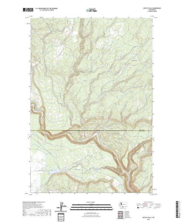
2023 Map of Outlet Falls
USGS Topo · Published 2023About this map
Outlet Falls serves as a central landmark in this landscape where the Klickitat River carves a deep path through the terrain. The map highlights a complex hydrographic network, including Outlet Creek and the stagnant waters of Mill Pond, which suggest a history of water management and early industry in this portion of Washington. To the southwest, the boundary of the Conboy Lake National Wildlife Refuge marks a significant conservation area, contrasting with the nearby agricultural and timber potential of Cedar Valley and Borde Flats.
Find a feature on this map
32 named features on this map. Tap any name to fly to it.
Don’t see what you’re looking for? This feature index may not catch every label — zoom into the map to look around manually.
Map Details
Editions of this 2023 Outlet Falls Map
This is the sole edition of this map. No revisions or reprints were ever made.
Other maps of this area

1904 · Mount Adams
USGS Topo · 1:125,000

1907 · Mount Adams
USGS Topo · 1:125,000

1934 · The Dalles
USGS Topo · 1:125,000

1950 · Yakima
USGS Topo · 1:250,000

1953 · The Dalles
USGS Topo · 1:250,000

1956 · The Dalles
USGS Topo · 1:250,000

1957 · The Dalles
USGS Topo · 1:250,000

1957 · Klickitat
USGS Topo · 1:62,500

1957 · Husum
USGS Topo · 1:62,500

1958 · Yakima
USGS Topo · 1:250,000