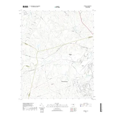
2019 Map of Overhills
USGS Topo · Published 2019About this map
Pope Army Airfield and the northern outskirts of Fayetteville anchor this 2019 survey, illustrating the significant military and suburban footprint in the Sandhills region of North Carolina. The map captures a complex intersection of four counties—Harnett, Moore, Hoke, and Cumberland—where the Little River and its numerous tributaries like Cypress Creek and McPherson Creek cut through the terrain. To the north, the historic Overhills estate area is marked by Overhills Lake, while Spring Lake serves as a central hub between the military reservation and growing residential developments.
Find a feature on this map
110 named features on this map. Tap any name to fly to it.
Don’t see what you’re looking for? This feature index may not catch every label — zoom into the map to look around manually.
Map Details
Editions of this 2019 Overhills Map
This is the sole edition of this map. No revisions or reprints were ever made.
Other maps of this area

1948 · Fayetteville
USGS Topo · 1:62,500

1948 · Clifdale
USGS Topo · 1:62,500

1948 · Nicholson Creek
USGS Topo · 1:24,000

1948 · Clifdale
USGS Topo · 1:24,000

1950 · Clifdale
USGS Topo · 1:24,000

1950 · Lobelia
USGS Topo · 1:24,000

1950 · Fayetteville
USGS Topo · 1:24,000

1950 · Manchester
USGS Topo · 1:24,000

1950 · Nicholson Creek
USGS Topo · 1:24,000

1951 · Clifdale
USGS Topo · 1:62,500