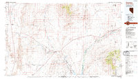
1987 Map of Overton
USGS Topo · Published 1988About this map
The Moapa River Indian Reservation and the fertile agricultural corridor of the Muddy River Valley anchor this 1987 survey of southeastern Nevada. This era shows the established rural communities of Logandale, Overton, and Glendale before the rapid suburban expansion from the Las Vegas valley reached this far northeast. The landscape is a study in desert hydrology and transportation, where the Union Pacific railroad and Interstate 15 parallel the Muddy River and Virgin River systems. To the west, the Las Vegas National Wildlife Range and Valley of Fire State Park protect large swaths of the arid terrain, while industrial history is represented by the Magnesite Mine near the base of the Muddy Mountains. To the east, the map captures the transition into Arizona at the Virgin Mountains, with the river flowing toward the northern reaches of Lake Mead.
Find a feature on this map
43 named features on this map. Tap any name to fly to it.
Don’t see what you’re looking for? This feature index may not catch every label — zoom into the map to look around manually.
Map Details
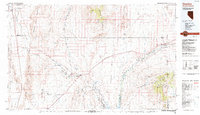
Editions of this 1987 Overton Map
2 editions found
Other maps of this area

1885 · St. George
USGS Topo · 1:250,000

1885 · Pioche
USGS Topo · 1:250,000

1886 · Saint Thomas
USGS Topo · 1:250,000

1886 · Mt. Trumbull
USGS Topo · 1:250,000

1886 · Pioche
USGS Topo · 1:250,000

1891 · St. George
USGS Topo · 1:250,000

1892 · Mt. Trumbull
USGS Topo · 1:250,000

1893 · Saint Thomas
USGS Topo · 1:250,000

1907 · Las Vegas
USGS Topo · 1:250,000

1908 · Las Vegas
USGS Topo · 1:250,000